If you hear the word Galilee in a Bible lesson, travel plan, or history discussion, you may wonder what place it actually describes. Is it a city, a lake, or a larger region? The answer is a region in northern Israel, known for green hills, agricultural valleys, historic towns, and the freshwater lake commonly called the Sea of Galilee.
Galilee has never been defined by one perfectly fixed border. Its meaning changes depending on whether someone is speaking about the biblical region, a historical province, or the modern geographical area. Still, the central idea remains consistent: Galilee is the northern part of the land historically associated with Israel, stretching from the Mediterranean coast and inland valleys toward the Lebanese border.
Galilee occupies the northern portion of the land between the Mediterranean Sea and the Jordan Valley. Its landscape includes the Upper Galilee mountains, the lower hills and valleys of Lower Galilee, and the basin surrounding the Sea of Galilee. To the west, the region approaches the Mediterranean coast; to the east, it descends toward the Jordan Rift Valley.
The region is generally divided into Upper Galilee and Lower Galilee. The names refer mainly to elevation rather than a simple north-and-south split. Upper Galilee is more mountainous, while Lower Galilee contains broader valleys, rounded hills, and many of the places most closely connected with the New Testament.
Upper Galilee: a higher, more rugged area with forested hills, deep valleys, and communities near the Lebanese border.
Lower Galilee: a lower hill country with agricultural plains, historic villages, and cities such as Nazareth.
The Sea of Galilee basin: a low-lying freshwater region surrounded by hills and connected to the Jordan River system.
The western approaches: valleys and coastal areas that historically linked Galilee with the Mediterranean ports and major inland routes.
Galilee is not the same thing as the Sea of Galilee. The lake takes its name from the surrounding region, and it is also known by other names, including Lake Kinneret and Lake Tiberias. In biblical writing, different names can refer to the same body of water.
Geographic distinction: “Galilee” usually means the broader northern region, while the “Sea of Galilee” means the inland lake at its eastern center. A reference to one does not automatically mean the other.
How Galilee is divided into its main landscapes
A useful way to understand Galilee is to follow its terrain from the mountains down to the lake and valleys. Each zone has shaped settlement, farming, transportation, and local culture in a different way.
Mountainous Upper Galilee: Higher ridges and wooded slopes create a cooler, more rugged environment. Roads often follow valleys and passes rather than crossing the steepest terrain directly.
Lower Galilee’s hill country: Rounded hills and open valleys support farming, grazing, and towns. This is the setting associated with Nazareth and many villages mentioned in historical accounts.
The Sea of Galilee: The lake provides a distinctive lowland landscape, with shoreline settlements, fishing traditions, and steep hills rising nearby.
The Jordan Valley: East of the lake, the land drops into the long geological depression that continues southward. The climate is generally warmer and drier than in the hills.
The Jezreel and other regional valleys: Broad agricultural areas have connected Galilee with central Israel and the coast, making them strategically significant throughout history.
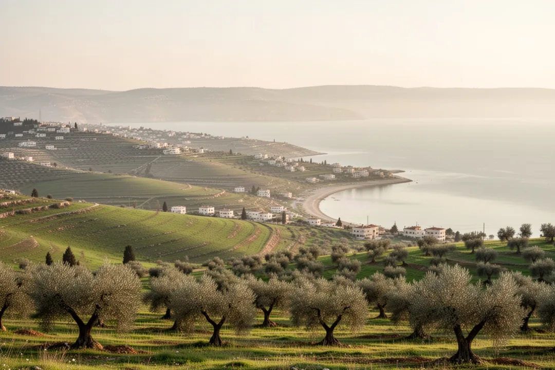
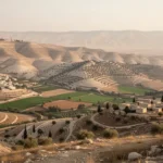
The region’s visual character can change quickly. A short drive may take you from olive groves and rocky hills to a broad green valley, then down toward a warm lakeshore. Rainfall, elevation, and distance from the Mediterranean all contribute to these contrasts.
Why Galilee matters in the Bible
Galilee is especially familiar to readers of the New Testament. Jesus grew up in Nazareth, a town in Lower Galilee, and much of his public ministry took place around the Sea of Galilee. The region is linked with his teaching, healings, calling of disciples, and movement among lakeside villages and hill-country communities.
The Gospels mention several Galilean locations. Nazareth is associated with Jesus’ upbringing. Capernaum, on or near the northwestern shore of the lake, becomes an important setting for his ministry. Bethsaida, Cana, Magdala, and other places appear in different Gospel accounts, although the precise identification of some ancient sites remains debated.
The Sea of Galilee provided both a physical setting and a livelihood. Several of Jesus’ disciples are described as fishermen, and Gospel narratives frequently place them in boats or along the shoreline. These accounts reflect the importance of fishing, small-scale agriculture, and movement by water in the ancient region.
Galilee also appears in the Hebrew Bible and earlier Jewish history. The area was shaped by the tribes traditionally associated with Naphtali, Asher, Zebulun, and Issachar, although the boundaries of ancient tribal territories should not be treated as identical to every later map of Galilee.
When biblical writers refer to a person as a Galilean, the term can identify regional origin as well as social and cultural background. Galilee stood at a crossroads, influenced by Jewish traditions, neighboring peoples, trade routes, and the political powers that controlled the area at different times.
Nazareth is one of Galilee’s best-known towns because of its association with Jesus’ early life. In the first century, it was a relatively small settlement rather than a major imperial center. Its significance in Christian tradition comes less from political importance than from its connection with the life of Jesus.
Modern Nazareth is a busy city with a predominantly Arab population and important Christian and Muslim sites. Visitors may encounter churches, old streets, markets, and viewpoints that reflect several layers of religious and urban history. The modern city should not be confused with a perfectly preserved first-century village; archaeological remains and later buildings exist side by side.
Capernaum and the northwestern shore
Capernaum is an archaeological site on the northwestern shore of the Sea of Galilee. It is associated with Jesus’ ministry and with several of his disciples. The ruins include remains of ancient domestic structures, a synagogue complex from a later period, and a shoreline setting that helps visitors picture the scale of the ancient villages.
The site is valuable because it brings together archaeology and Gospel geography. Rather than treating the stories as occurring in an abstract landscape, you can see the relationship between houses, public buildings, the lake, and the surrounding slopes. Some structures visible today date from periods after Jesus’ lifetime, so interpretation requires attention to chronology.
The Sea of Galilee as a living landscape
The lake is approximately eleven miles long from north to south, although measurements can vary according to the point used and the water level. It lies below sea level and is surrounded by hills, with the Jordan River entering from the north and continuing southward from the lake.
Its shoreline has changed through modern development, environmental pressures, water management, and fluctuating water levels. The lake remains a major visual and cultural feature of Galilee, but a present-day visit will not reproduce the exact shoreline conditions of the first century.
For biblical study: Read the geographical references alongside a map. “Galilee,” “Judea,” Samaria, the Jordan Valley, and the lake describe connected but distinct areas, and the distances between them help clarify the narrative.
How Galilee developed through history
Galilee’s location made it both a homeland and a passageway. Routes connecting the Mediterranean coast, the inland valleys, Syria, and the Jordan Valley crossed or approached the area. As a result, Galilee experienced the influence of local kingdoms, regional empires, Jewish rulers, and Roman administration.
During the period of the ancient Israelite kingdoms, settlements in Galilee formed part of the northern political and cultural landscape. The region later came under Assyrian control, and population movements altered the character of many communities. Centuries of changing rule left Galilee with a complex history rather than a single uninterrupted identity.
In the Hellenistic period, Greek political and cultural influence reached the region. Later, Hasmonean rulers expanded Jewish control into Galilee, and the area became part of the political world inherited by the Herodian dynasty and then governed under Roman authority.
By the first century, Galilee contained Jewish villages, agricultural communities, fishing settlements, and larger administrative centers in the wider region. Ancient Galileans were not isolated from the rest of the eastern Mediterranean. They participated in trade, paid taxes, traveled for religious observance, and encountered multiple languages and political institutions.
After the Roman period, Galilee remained an important center of Jewish learning. The Mishnah and later rabbinic traditions were compiled and developed in a broader scholarly environment that included Galilean towns. Jewish communities continued to shape the region even as political control changed.
Christian, Muslim, Jewish, Druze, and other communities have all contributed to Galilee’s history. Medieval churches, mosques, synagogues, shrines, cemeteries, villages, and agricultural terraces reflect this long period of overlapping settlement. The region’s identity today cannot be reduced to a single biblical era.
Galilee’s climate changes with elevation and distance from the coast. Mountain areas are generally cooler and receive more winter rain than the lowlands around the lake. The Sea of Galilee basin is warmer, while the Jordan Valley can feel considerably hotter and drier.
Winter brings much of the region’s rainfall, and hills may appear green during the wet season. In spring, wildflowers and cultivated fields can add color to the landscape. Summer is typically dry, with strong sunlight and high temperatures, especially near the lake and lower valleys.
Vegetation includes olive trees, fig trees, vineyards, citrus orchards, oak woodland, planted forests, and seasonal grasses. Farming has long depended on local soils, rainfall, terracing, irrigation, and access to markets. In some places, ancient agricultural patterns remain visible in stone walls and hillside terraces.
The terrain also helps explain why certain historic settlements grew where they did. A town near a spring, fertile valley, defensible hill, lake landing, or road junction had practical advantages. The landscape was not simply a backdrop to history; it influenced where people lived and how they worked.
What to see on a Galilee trip
A trip through Galilee can focus on religious sites, archaeology, natural scenery, food, or local communities. Because the region is spread across mountains, valleys, and lakeshore roads, grouping nearby places together makes the experience more manageable.
Nazareth: Explore major Christian landmarks, historic streets, markets, and views over the surrounding hills.
The Sea of Galilee shore: Visit lakeside sites, walking areas, boat excursions where available, and viewpoints over the water.
Capernaum and nearby archaeological sites: Examine ruins connected with ancient village life and the New Testament landscape.
Tabgha and surrounding pilgrimage locations: See churches and religious sites associated with Gospel traditions, while checking opening arrangements before traveling.
Tiberias: Use the lakeside city as a base for exploring the lake, nearby hot springs, historic remains, and regional food.
Upper Galilee: Travel through mountain scenery, nature reserves, forests, and small communities in the northern hills.
Safed: Learn about Jewish mystical traditions, historic synagogues, artists’ quarters, and the city’s elevated setting.
Akko and the western edge: Combine Galilean travel with the fortified coastal city’s markets, harbor, and layered history.
Religious sites often have specific expectations about clothing, photography, behavior, and visiting hours. Modest clothing and quiet conduct are appropriate at churches, synagogues, mosques, cemeteries, and other sacred places.
How to plan transportation and timing
A car is often the most flexible way to explore Galilee because attractions are dispersed and rural roads connect many of the most scenic locations. Public transportation can work well between larger cities, but reaching archaeological sites, nature areas, and small villages may require careful planning or a local tour.
Allow more time than a map distance may suggest. Mountain roads, traffic near cities, stops at viewpoints, and limited opening hours can make a short route take much of a day. A plan that includes both Nazareth and the northern lake shore, for example, should account for visits rather than treating the places as quick roadside stops.
Spring and fall are often comfortable seasons for walking and sightseeing, while summer can be hot around the lake and in the valleys. Winter weather may be rainy, and some trails or outdoor sites can become muddy. Check official opening information, transportation schedules, and local travel guidance before setting out.
When traveling near borders or areas affected by political and security concerns, consult current U.S. State Department guidance and local authorities. Conditions can change quickly, and historical importance does not remove the need for practical safety planning.
What food and culture reveal about Galilee
Galilean food reflects the region’s farming communities, Arab and Jewish traditions, Mediterranean ingredients, and proximity to the lake. Meals may include flatbreads, hummus, olives, seasonal vegetables, dairy products, grilled meats, fish, herbs, and fruit. Preparation varies widely from one town and household to another.
Olive oil is central to many local food traditions, and olive groves remain a familiar part of the landscape. Markets and restaurants may also feature regional cheeses, za’atar, tahini, dates, figs, and locally grown produce. The most useful approach is to ask how a dish is prepared rather than assuming that every “Galilean” label describes one standardized cuisine.
Galilee is home to diverse communities, including Arab Muslims and Christians, Jewish communities, Druze villages, and others. Some towns are strongly associated with one community, while larger cities and commercial areas bring different populations into daily contact.
Language also reflects this diversity. Hebrew and Arabic are widely used in different contexts, and English is common in many tourism settings. Learning a few respectful greetings, following local customs, and asking before photographing people or religious ceremonies can make interactions more considerate.
How Galilee differs from Judea and Samaria
Readers sometimes confuse Galilee with Judea because both appear frequently in biblical and historical accounts. They are separate regions. Galilee lies in the north, Judea traditionally centers on the area around Jerusalem and the southern hill country, and Samaria lies between them.
The differences are geographic as well as political. Galilee is characterized by northern mountains, valleys, and the Sea of Galilee, while Judea is associated with the central and southern highlands. Samaria occupies much of the central hill country. Ancient boundaries shifted, so maps from different periods may not match one another exactly.
These regional distinctions help explain movement in the Gospels and other historical texts. A journey from Galilee to Jerusalem was not simply a trip between neighboring neighborhoods; it crossed varied terrain and, depending on the route and period, involved different communities and political conditions.
How to read references to “Galilee” accurately
When you encounter Galilee in a text, first ask which period the writer means. A reference may concern the tribal era, the kingdom period, Roman Galilee, rabbinic Jewish history, the Crusades, Ottoman administration, or the modern region. The same place name can carry different boundaries in each setting.
Next, identify whether the reference is to a place of origin, a political district, a landscape, or a religious setting. “Jesus of Nazareth” identifies a town, while “Galilean” identifies a broader regional connection. “The Sea of Galilee” identifies a lake within that region.
Finally, use several kinds of evidence together. Maps show physical relationships, historical sources describe changing boundaries, archaeological remains reveal settlement patterns, and biblical passages provide narrative context. No single modern map can answer every question about ancient Galilee.
The most accurate picture is therefore both specific and flexible. Galilee is a real northern landscape with identifiable towns and natural features, but its borders and meaning have changed across centuries. Understanding that distinction makes the region easier to study, visit, and place within biblical history.
Frequently asked questions
Is Galilee a city or a region?
Galilee is a region, not a single city. It includes Upper and Lower Galilee, the hills and valleys of northern Israel, and the area surrounding the Sea of Galilee. Nazareth, Tiberias, Safed, and many smaller communities are located in or associated with Galilee, but none of them is the region itself.
Where was Jesus from in Galilee?
Jesus is traditionally associated with Nazareth, a town in Lower Galilee, where the Gospels describe him as growing up. Much of his public ministry took place elsewhere in Galilee, particularly around the Sea of Galilee and towns such as Capernaum. These locations represent different parts of the same broader region.
Can you swim in the Sea of Galilee?
Swimming is possible at designated areas, but conditions vary by season, water level, weather, and local regulations. Use an authorized beach, follow posted instructions, and be cautious about heat, sun exposure, boat traffic, and changing shoreline conditions. Check current local information before entering the water.
What is the best time to visit Galilee?
Spring and fall are often the most comfortable seasons for sightseeing, hiking, and visiting outdoor archaeological sites. Summer can be very hot, especially near the lake and in lower valleys, while winter brings more rain and occasionally difficult trail conditions. Your best dates also depend on religious holidays, site schedules, and current travel guidance.









Leave a Reply